
San Diego, 09.07.2019. Esri UC
This is actually for a client of mine and for a friend who’s working on a similar project (you know who you are, guys). As the smartest among you might have figured out by now, I’m involved in some airport stuff.
I took a careful approach and started with an Esri demo on ArcGIS for Aviation: they have some nifty little tools and, in combo with some workflows for bringing in stuff from Revit and Civil 3d (a post I’m probably going to put online this evening or in the upcoming days), this might prove to be something that solves part of our problems out there.
The demo was divided into the showcase of four different features of ArcGIS Pro:
- Preserve Data Quality (of course);
- Perform Obstacle Analysis;
- Manage Signage and Markings (this is something we might choose to keep doing into our BIM authoring tool, but it’s always good to know);
- Share your work with everybody else.
Now, this was really useful because we sometimes assume that we can do everything with Revit (and Dynamo makes phenomenon this worst), but there’s a whole world of tools out there and some of them are really neat. Just don’t try this at home and never, ever in the first phases of your implementation. In the first phases, one new tool by itself is more than enough.
Since point 1 is will be deeply explored in another post, I’m just going to give you some of the hints that were given in relation to point 2. And if you’re curious about something else, drop a note in the comment section, ok?
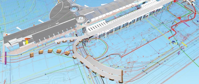
I’ve waited 40 hours to see this airport.
2. Obstacle Management and Analysis
It’s intuitive enough that when you’re flying on a plane you don’t want to hit things. Now, this is not strictly the airport business unless you have a runway which trajectory brings you against a tree. That is very much the airport business.
On the design side of things, you generally don’t need to take care of it if you’re just some fancy Firm doing the terminal but you do need to take care of it if you have the runways as well. And if you’re not performing this kind of check, be sure that someone else on the client’s side is. And you need to talk to them.
ArcGIS Pro has a nice set of out of the box tools that check the runway against surrounding obstacles in accordance with the regulation you prefer. If you’re curious about this at all, you might want to check out this page.
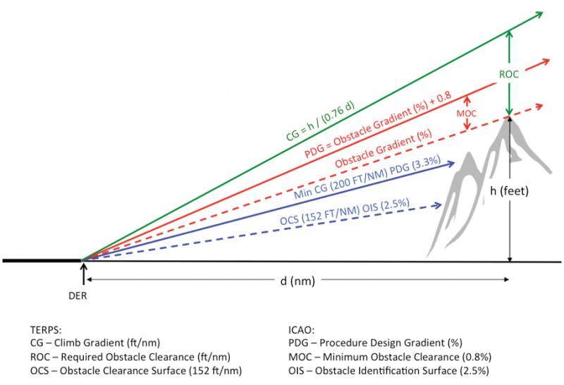
This is pretty much the issue.
The function of this toolbox is explained in detail here.
What it basically does is reading a geometrical feature you pick (such as the runway mid-road line), generates a surface (and then a volume) for the plane possible trajectories and runs a clash between that surface and surrounding elements such as buildings, trees, terrain.

I’m guessing you can use the tool just to generate the volume and then export it to perform your clash in Navisworks if you want to centralize all clash detection in a single tool.
The important part is that you don’t need to code a script to generate the surface in accordance with the given rules. And this means you can get out earlier and go grab a beer. Which, of course, is always the ultimate goal here.
.

 .
.


No Comments